 News
News 
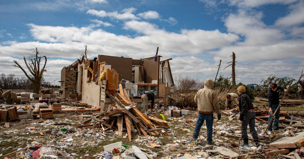
Thunderstorms were lashing parts of the Midwest with potent winds and large hail on Tuesday afternoon, only days after an outbreak of strong tornadoes tore through parts of the central U.S. and blizzard conditions affected the northern tier. The similarly volatile storm system was expected to deliver extreme weather conditions to many of the same states on Tuesday and into Wednesday.
On the warmer side of the storm system, more than a dozen states, from Wisconsin to Texas, were again at risk for severe weather. The most probable regions expected to be impacted by damaging winds and tornadoes were in Iowa, Illinois, Missouri and Arkansas.
Here’s what to expect around the country.
By early afternoon as storms moved over eastern Iowa, there were reports of destructive, windblown baseball-size hail in towns in northeast Illinois, according to the National Weather Service in Chicago, which also noted that gusts could be as high as 80 miles per hour on the border of Ogle and Lee Counties.
“This is a DANGEROUS storm,’’ the service warned. “If you’re in it’s path, take cover away from windows!”
Officials elsewhere had also cautioned residents in affected areas to be prepared for deteriorating conditions.
“The danger of a rain-shrouded tornado in the dark is significantly higher than it is during the daytime hours, when everybody’s out and about, paying attention,” said Jon Green, a Supervisor for Johnson County, Iowa, parts of which were slammed days ago by violent weather. A 24-unit building in Coralville, about 20 miles south of Cedar Rapids, was rendered “uninhabitable,” Mr. Green said. A derecho storm in 2020 had left residents particularly on edge, he added.
The Weather Service’s office for Quad Cities, a group of cities in Iowa and Illinois, said the area could receive three rounds of severe weather beginning Tuesday afternoon. The second and third rounds will arrive Tuesday evening and early Wednesday. At the most severe point, storms are expected to be moving at 50 to 60 miles per hour.
Voters in Chicago appeared to have heeded a call to vote early on Monday, ahead of bad weather on Tuesday, according to Max Bever, a spokesman for the Chicago Board of Election. As of noon local time, more than 364,500 ballots were cast in the mayoral runoff race, reflecting a 22.9 percent citywide turnout, compared to 21 percent at noon of the last election on Feb. 28.
“Strong, potentially long track tornadoes are possible, in addition to large hail and damaging winds,” Storm Prediction Center forecasters said Tuesday morning. Some of which are likely to occur at night.
By late Tuesday night, severe weather will begin moving over parts of the South. In the southern section of Arkansas and Texas, forecasters said confidence was increasing in the potential for rare and dangerous overnight tornadoes and damaging winds. Nocturnal tornadoes are not rare, but stronger nighttime tornadoes, like what could occur here, are.
Meteorologists with the Weather Service in Little Rock, Ark., warned residents on Tuesday morning to remain alert for this very reason.
“Severe weather fatigue is very real,” forecasters said. Tuesday night’s forecast, with threats after midnight, may lead to “a false sense of security as nothing happens during the day,” they warned.
The timing of the storms could lead to a “higher vulnerability,” forecasters said, stressing the importance of staying aware and having multiple methods of receiving alerts, even those that can wake a person up from sleep.
To the north of the center of the storm system, heavy snow of a foot to even two feet is possible from the Rockies to the upper Midwest. These snow amounts could challenge some April snow records in the Dakotas and northwest Minnesota, forecasters with the Weather Prediction Center said Monday afternoon.
24World Media does not take any responsibility of the information you see on this page. The content this page contains is from independent third-party content provider. If you have any concerns regarding the content, please free to write us here: contact@24worldmedia.com